Got on the Nelsonville storm right before the reported tornado there. We got in great position to watch as the wall cloud developed and tightened up. There was rapid rotation as the RFD cut into the updraft. Couldn't follow the storm eastward as the terrain and road patterns didn't support keepeing up with a storm moving 45+mph. We dropped south and watched the next two supercells pass by with not much in the way of structure to be seen in the terrible, hilly, terrain. Here are some images of the Nelsonville storm:
Initial view from a distance of the towers shooting up in the atmosphere:

Once under the rainfree updraft base, it provided an interesting view with the anvil in the background for contrast:

The broad mesocyclone developed a large wall cloud that is to the left in the picture. The wall cloud was rotating rapidly and just wanted to drop a tornado. Here are three shots in chronological order as it moved eastward:


We jumped back in the car and shot southeastward in hopes of catching up but to no avail. Here is an artsy shot of Alex looking at the wall cloud:

After giving up on that storm we stopped and waited for the next supercell to come to us at a rare high point in the hills. Here is the base of the second storm:

Its stucture looked cool up against the setting sun:


Heading back towards Athens we saw the backend of the supercell that went right over the city:

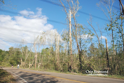
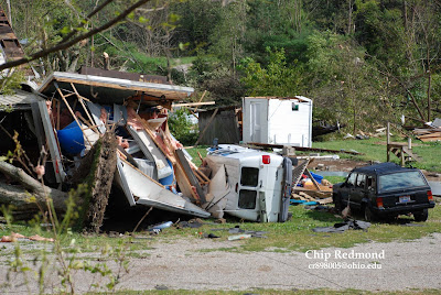
We returned to Athens after the storms passing to find the damage on the east side of town to the Auto Tech building. It was very heavily damaged, but not wiped clean as the SPC report made it out to be. Looking at the damage and the way the debris was blown around, the winds at this location were very, very strong. However, all the debris was laid out in a west to east fashion that is typical of a downburst/microburst. The only evidence that there may of been a tornado was the debris caught on both sides of the fence as seen here:

Here are the young trees snapped of very low to the ground characteristic of very high winds:


The classic debris in the powerline shot:

Damage and parts from the Auto Tech building in front of the next door motel:

The front of the damaged building:

It is never good to see storms and their resulting damage like this. My hopes and prayers to all those affected. It was however, likely a hundred year event and I'm glad to say that I got to witness it. I hope it is a big wake up call to these counties that rarely every have something like this happen that they to need to be prepared. Even Ohio University needs to take a huge lesson from this.
Chip


