 |
| Storms initiating in NE SD |
 |
| Storm's cold pools organizing into a MCS |
 |
| Shelf cloud emerging at the base |
 |
| Gorgeous structure |
 |
| Bow echo had a clear bookend vorticy to the north |
 |
| Meso moving into Ortonville |
 |
| Tornado visible at the base of the storm. Debris cloud left of the light pole, funnel to the right |
 |
| Cropped version of above photo |
 |
| Tornado moving farther to the east/south and stacked plates above it |
 |
| Cropped version of the above photo showing the tornado with funnel a bit more visible to the right of the pole |
 |
| Amazing structure and a huge hail core |
 |
| Greenness! And the gas station we took cover at |
 |
| Next storm just east of Watertown, SD. Clear base with a wall cloud and rainbow |
 |
| Storm beginning to fall apart |
 |
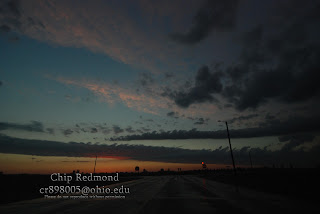
| Pretty sunset looking the opposite way |
 |
| Zoomed in version |
 |
| Storm is still trying |
 |
| Very pretty backside of the cumulonimbus |
And thus, ended our day. Kind of a disappointment because we were really hoping for some isolated supercells. Everything developed to fast and the cap gave way to a massive amount of "crap"-vection that helped the storms go linear quickly. We happened to get very lucky by being at the right place at the right time and were able to bag that tornado. It is good to finally get the first tornado of 2012 though!
Chip


No comments:
Post a Comment